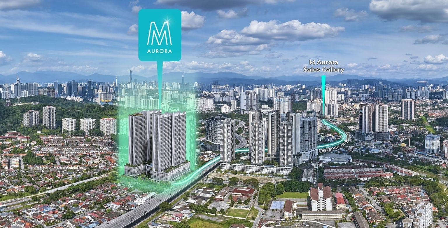
Ask any seasoned Klang Valley buyer what makes Old Klang Road work, and the answer rarely starts with the buildings — it starts with access. Jalan Klang Lama is one of Kuala Lumpur's original arterial spines, and it has accumulated something most addresses can only envy: two walkable commuter-rail stations, a thick web of expressways, and a planned orbital MRT line on the horizon. This guide lays out the real commuting picture — what is genuinely close, what the indicative journey times look like, and how the connectivity story is set to deepen.
The 30-second read
- Two KTM Komuter stations within walking distance — Jalan Templer (~500 m) and Petaling (~600 m).
- KL Sentral indicatively ~15 min by rail; Mid Valley about 6.8 km by road.
- Direct feeds to NPE, Federal, KESAS, MEX, Salak and the KL–Seremban Expressway.
- The future MRT3 Circle Line (~2.5 km) would add a second rail mode to the corridor.
The dual-KTM story: two stations, one corridor
Most KL neighbourhoods are lucky to have one rail station within walking distance. Old Klang Road has two KTM Komuter stations on the Port Klang line: Jalan Templer (about 500 m, ~6 minutes' walk) and Petaling (about 600 m, ~8 minutes' walk). From here, KL Sentral is indicatively around 15 minutes by rail — and that single interchange is the key, because KL Sentral is where the entire network converges: KTM Komuter, LRT, MRT, the KL Monorail, KLIA Transit and the ERL airport link. For context, the KTM Komuter hop between Mid Valley/Seputeh and KL Sentral runs in the order of 5–13 minutes depending on the schedule (KTMB; klsentral.info), which underlines how short these inner-corridor rail legs are. Two stations also means redundancy — if one is inconvenient on a given day, the other is a short walk away.
Indicative journey times that matter
Numbers tell the story better than adjectives. The figures below are indicative — rail times depend on KTM frequency and schedule; road times swing with traffic — but they sketch a realistic daily picture for someone based on the corridor near M Aurora.
| Destination | How | Indicative time / distance |
|---|---|---|
| KL Sentral | KTM Komuter from Jalan Templer / Petaling | ≈ 15 min by rail |
| Mid Valley / KL Eco City | Road via NPE / Federal | ≈ 6.8 km |
| KLCC / city centre | Rail via KL Sentral, or road | ≈ 20–30 min (traffic-dependent) |
| Petaling Jaya / Bangsar South | Road via NPE | ≈ 15–25 min (traffic-dependent) |
| University Malaya | Road | ≈ 10 min |
| Bukit Jalil | Road via KESAS / KL–Seremban | ≈ 6.3 km |
| KLIA / klia2 | Road via MEX, or ERL from KL Sentral | ≈ 45–60 min (traffic-dependent) |
Six highways: the driver's corridor
For those who drive, Old Klang Road's expressway access is its quiet superpower. The corridor feeds directly onto the New Pantai Expressway (NPE) toward PJ, Bangsar South and the west; the Federal Highway toward the city and Klang; the KESAS for east–west Klang Valley travel; the MEX straight down to Putrajaya, Cyberjaya and KLIA; plus the Salak and KL–Seremban Expressway links toward the south. Few KL corridors offer this many independent road choices from one location — which means that when one route snarls, another is usually open. That optionality is exactly what makes daily driving here more forgiving than the density of the main road might suggest.
The MRT3 Circle Line: the upside on the horizon
The connectivity story is not finished — it is about to get a second chapter. The MRT3 Circle Line is a planned 51.6 km orbital line with 33 stations designed to close the loop around Kuala Lumpur and interchange with the existing MRT, LRT, KTM and Monorail network. Its Final Railway Scheme was approved in July 2025, with construction targeted to begin in 2027 and operations around 2032 (Malay Mail; MRT Corp). A station is anticipated in the Jalan Klang Lama vicinity — indicatively about 2.5 km from the M Aurora area — which would layer a second rail mode on top of the corridor's existing dual-KTM access. Alignment, station siting and timelines remain subject to the authorities, so treat this as a credible medium-term upside rather than a present-day amenity. For a long-hold owner or investor, though, buying ahead of confirmed rail is precisely how connectivity premiums are captured.
What it all adds up to
Strip away the marketing and the corridor's transport case is simple and strong: two walkable KTM stations today, six highways for the driver, and a planned MRT3 station for tomorrow. That combination — rail redundancy now, expressway optionality always, and orbital rail coming — is rare in Kuala Lumpur, and it is the single most durable reason the Jalan Klang Lama corridor stays tenanted and liveable through the cycle. If your priority is getting to work, to the airport and across the Klang Valley without building your life around one fragile route, Old Klang Road earns its place on the shortlist.
Want your own commute mapped from M Aurora?
Tell Kevin Lee where you work and travel, and he'll lay out the realistic rail-and-road options and times for your routine — free and with no obligation.
💬 Map my commuteSources: Malay Mail — MRT3 Final Railway Scheme approval (July 2025); MRT Corp — Circle Line (MRT3); klsentral.info — KTM Komuter to KL Sentral travel times; KTMB — KTM Komuter. Journey times, distances and MRT3 station siting are indicative, drawn from public sources and developer materials, and remain subject to schedules, traffic and the authorities.
This article is general information by Kevin Lee (REN 14973, FLP Realty Sdn Bhd) and not financial advice. Journey times, distances and infrastructure timelines are indicative, based on publicly available information and the author's analysis as at June 2026, and may change; the MRT3 alignment and schedule are subject to the relevant authorities. Verify all details independently before making any decision. E&OE.